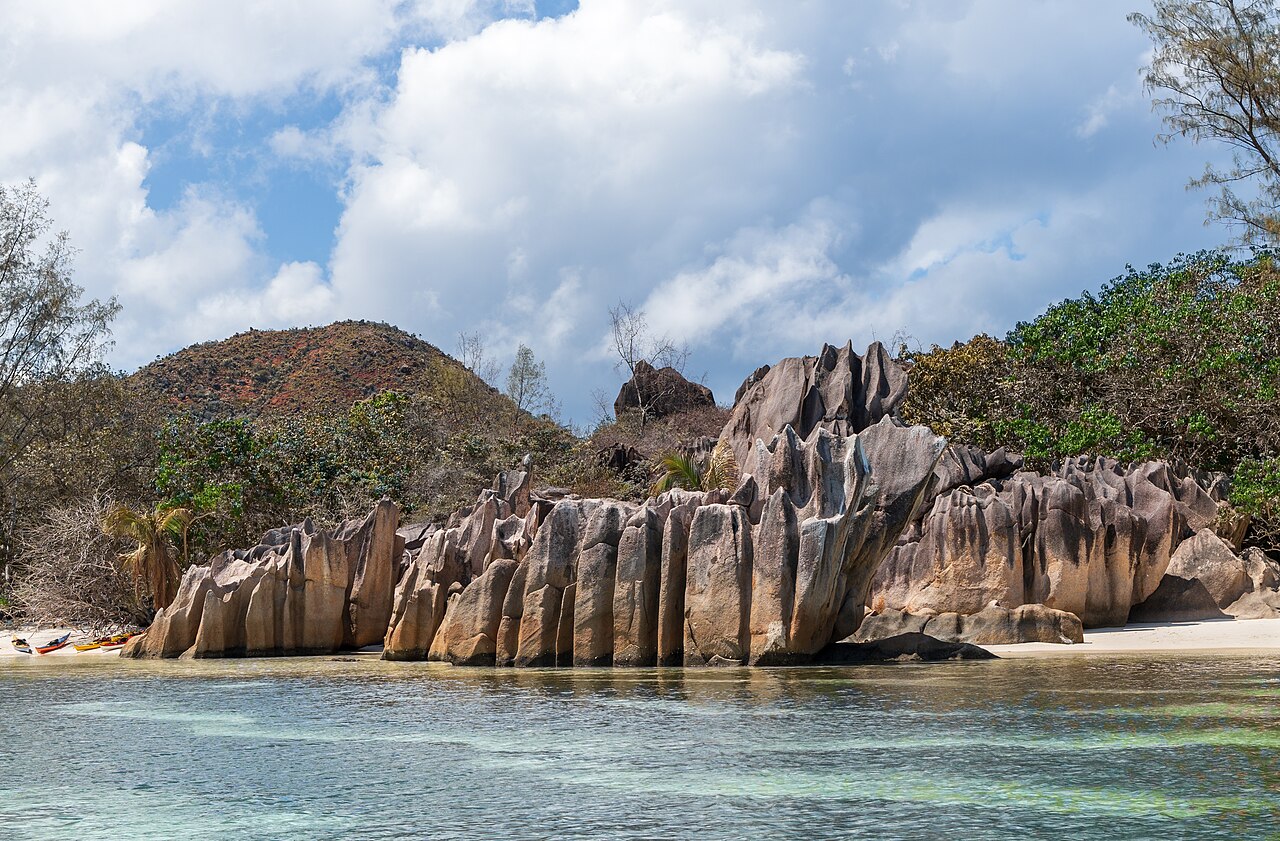
Seychelles is not a coral atoll. It is a piece of continental granite, and the continent it came off is yours.
One ocean, and one rock
The islands were part of India until the Deccan eruptions pushed them away. The sea still runs on the same calendar.
You are not flying to a coral island
Almost every tropical island group is one of two things. Either coral built it, or a volcano did. Seychelles is neither. The inner islands are continental granite, the rock is late Precambrian, and the continent it broke off is the one you are flying from.
That single fact explains most of what the place looks like, and the monsoon that follows from the same map explains most of what your week will feel like.
The photograph above: NorbertNagel, CC BY-SA 4.0
One rock, split twice
The granite cooled about 750 million years ago, in the late Precambrian, as part of the crust that became peninsular India. Gondwana began breaking up around 167 million years ago and the eastern half of it, Antarctica and Madagascar and India and Australia, went as one piece. About 115 to 120 million years ago that piece began to come apart in turn and India started moving north.
The Seychelles block was cut loose twice. Between about 95 and 84 million years ago rifting separated Seychelles and India together from Madagascar. Then, about 66 million years ago, the rift jumped again and severed Seychelles from India, opening the Carlsberg Ridge, which is still spreading now.
The Deccan is the other half of the story
That second split happened at the maximum output of the Deccan Traps, and the two events are generally treated as connected. Volcanic rock on the Seychelles plateau has been tied to the same episode.
So the basalt under Nashik and the granite under Mahé are two ends of one story. One plateau stayed on the plate that carried on north and became India. The other fragment stopped where it was, sank most of the way, and left a handful of mountain tops standing out of the water. Alfred Wegener pointed at these outcrops when he was still trying to convince people that continents move at all.
Why the beaches look like that
Coral makes flat islands. Volcanoes make black sand and steep cones. Continental granite makes what you have seen in the photographs, which is a mountain in the sea with rounded boulders the size of houses standing in white sand at the bottom of it.
Those boulders are weathered granite, and their shape is the reason Anse Source d'Argent turns up on most lists of the world's best beaches. The same rock builds the ridge behind Victoria, the fins along the shore of Curieuse and the bare grey slabs on Aride with dark mineral seams running through them. Our beaches pages are a tour of one rock formation.
The monsoon you already know
Seychelles sits in the same wind system as the Indian coast and runs on the same calendar, which is why an Indian traveller has an advantage here that a European one does not. You already understand the year.
From roughly December to March the north-west monsoon blows, and the sheltered coasts are the south and the east. From roughly May to September the south-east trades take over and the sheltered coasts are the north and the west. April and October are the turns between the two systems, the wind drops to nothing and every coast on every island goes calm at once.
This is the single most useful thing on this website. It does not tell you when to come. It tells you which side of the island to be on when you get here. The calm calendar sets it out month by month.
The days out
Island tours, boat days, snorkelling and walks, with real ratings, real review counts and free cancellation up to twenty-four hours before.
See the toursSeaweed, and the honest version
The same winds that decide which coast is calm also decide which coast collects sargassum. Between roughly May and September the south-easterly beaches on Mahé gather weed along the tide line, and between December and March the north-western ones can. It is seasonal, it is natural, and it gets cleared from the hotel frontages and not from the public beaches.
It is not the sort of thing a brochure photograph shows. It is worth knowing because it is exactly the sort of thing that makes a good beach look like a bad one on the wrong week, when the answer is simply to drive twenty minutes to the other side.
The sea between
There is a great deal of nothing between the two countries. The Seychelles bank is a shallow plateau with the granite islands standing on it, and beyond its edge the sea floor drops away for thousands of metres in every direction. That isolation is why so much of the wildlife here went its own way.
It is also why there is no direct shipping line, which India's own bilateral brief names as the main reason trade between the two countries stays small. A great deal of water is a real obstacle even now.
What to do with all this on the ground
Stand on Anse Source d'Argent and put your hand on one of the boulders. That rock is older than almost anything you will ever touch and it was continuous with the Indian shield when it formed. Nothing else on the trip gives you that.
Then use the wind rule. Book the island and the coast to the calendar rather than to the photograph, take the ferry rather than fighting the sea, and treat April and October as the two weeks in the year when it genuinely does not matter where you stay.
One ocean, and one rock, in three frames.
Granite, not coral. The rock in the first two frames is about 750 million years old and was continuous with the Indian shield when it formed.
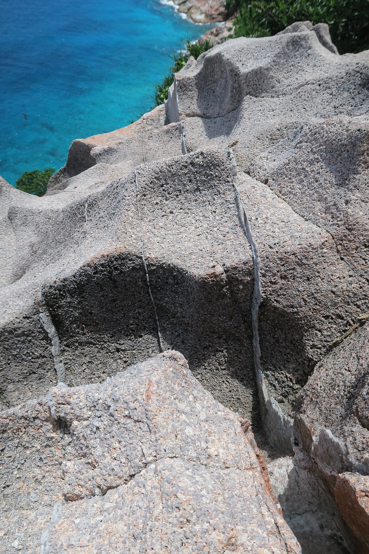
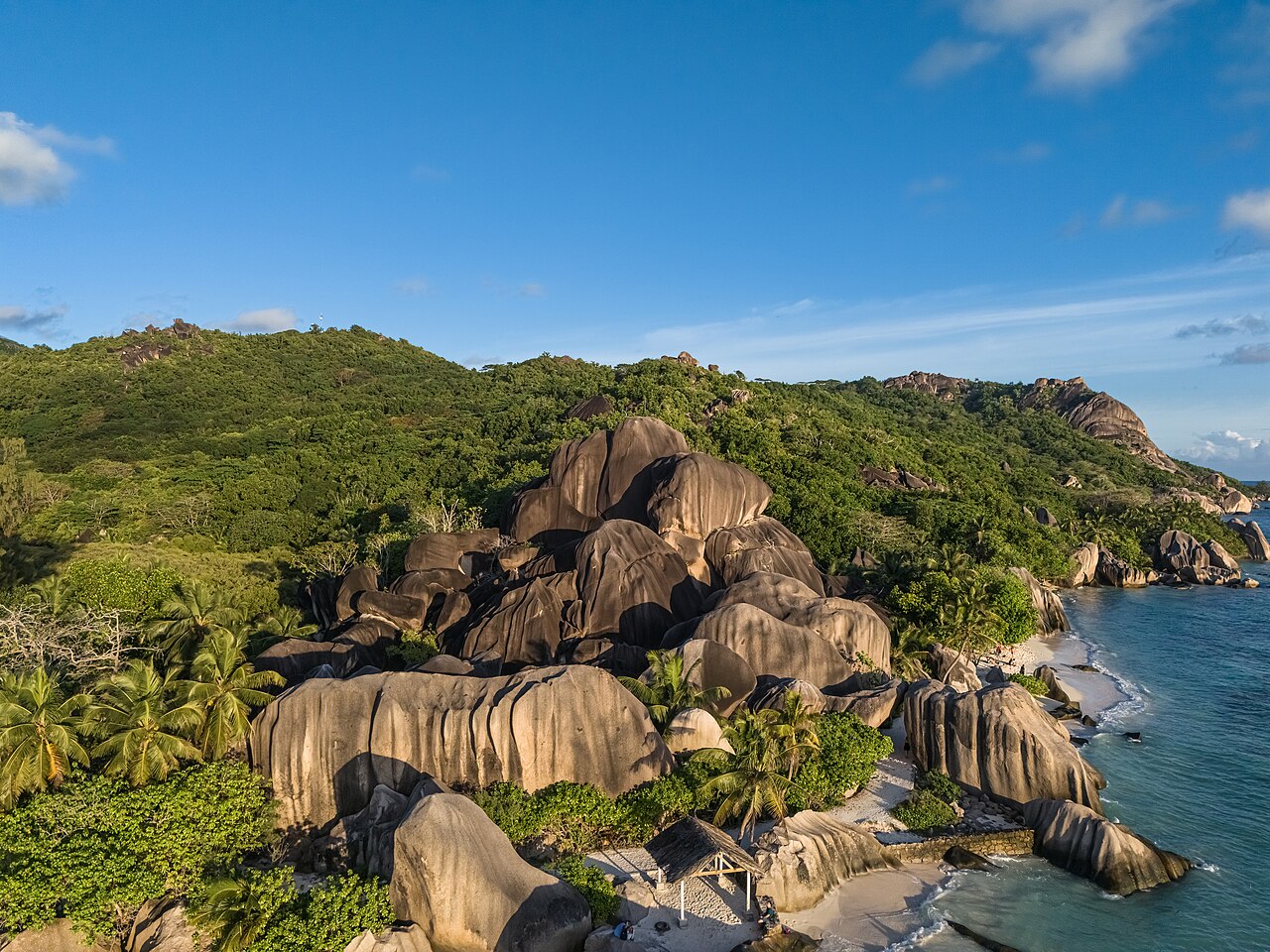
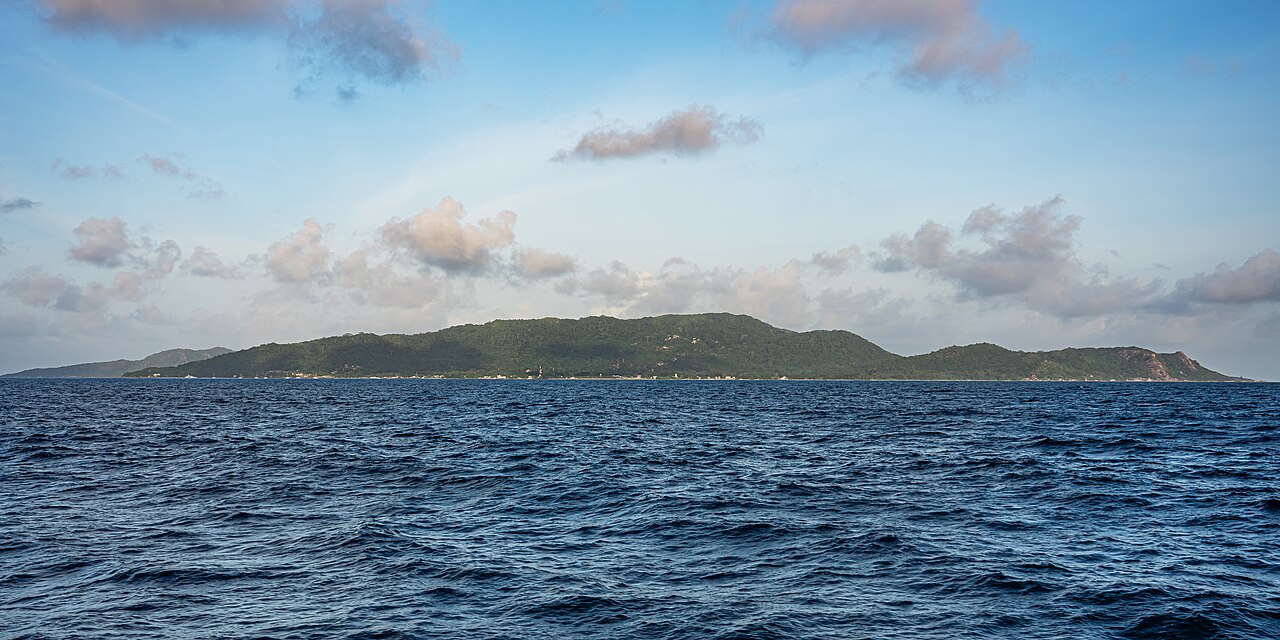
Photographs, under Creative Commons: Etan J. Tal, CC BY-SA 4.0 A.Savin, FAL A.Savin, FAL
What people ask.
Was Seychelles part of India?
Yes. The granite of the inner islands formed about 750 million years ago as part of the same continental crust as peninsular India, and rifting only separated the two about 66 million years ago. Seychelles is a continental fragment, not a coral atoll or a volcano.
What is the Seychelles microcontinent?
The block of late Precambrian continental rock that the granitic Seychelles stand on. It was cut from Madagascar between about 95 and 84 million years ago and from India about 66 million years ago, when the Carlsberg Ridge opened.
Why does Seychelles have granite boulders on its beaches?
Because the islands are continental crust rather than coral or lava. The boulders are weathered granite from the same 750 million year old rock that forms the mountains inland, and they are the reason the beaches here look unlike anywhere else in the tropics.
Does the monsoon affect Seychelles?
Directly. The north-west monsoon runs roughly December to March and the south-east trades roughly May to September, and between them they decide which coast of each island is calm. December to March the sheltered coasts are the south and east. May to September they are the north and west. April and October are calm everywhere.
Is there seaweed on Seychelles beaches?
Seasonally, yes. The windward coast of the moment collects sargassum along the tide line, so between May and September it is the south-eastern beaches on Mahé and between December and March it can be the north-western ones. The answer is to move to the sheltered side, which is a twenty minute drive.
How far is Seychelles from India?
Far enough that there is no direct shipping line, which India's own bilateral brief names as the main reason trade between the two countries remains modest. The sea floor between them drops to several thousand metres once you leave the Seychelles bank.
Where every fact on this page comes from
- Ministry of External Affairs, Government of India, India-Seychelles Bilateral Relations, brief dated 27 August 2024, source
- High Commission of India, Victoria, contact and office hours, source
- Ministry of Foreign Affairs and the Diaspora, Republic of Seychelles, list of public holidays, source
- National Bureau of Statistics, Seychelles, Population and Housing Census 2022, source
- Hinduism in Seychelles, for the census religion series and the temple's consecration, source
- Seychelles microcontinent, for the rifting dates and the Deccan connection, source
- Seychellois rupee, for the 1914 currency ordinance, source
- Operation Flowers are Blooming, for the 1986 naval visit, source
- Seychelles, for the 1503 sighting and for the Seychellois account of the 1770 landing, source
- National Bureau of Statistics, Seychelles, Weekly Visitor Arrivals, bulletin VASB52 2025, released 31 December 2025, for the complete 2025 calendar year, source
- National Bureau of Statistics, Seychelles, Weekly Visitor Arrivals, bulletin VASB35 2026, released 2 September 2026, for the year so far, source
Six of these eleven are first-party. India's own foreign ministry, India's own High Commission in Victoria, the Seychelles foreign ministry and the Seychelles statistics bureau, the last of those three times over. Nothing on these pages comes from a travel site, a listing or a directory, and for most of these facts those were what search returned first. Every link was checked before publication. Figures move, so check the source rather than us if a number matters to a decision.
Book to the wind, not to the photograph
Tell us your dates and we will tell you which coast will be calm in them, then price the car, the transfers and the days out around that.